Want to escape ? Give yourself a moment of freedom with this route original to browse in car or camping-car across three departments (Aveyron, Cantal, Lozère). Outdoor enthusiasts looking for authenticity, all you need is a full day to enjoy the sumptuous landscapes volcanic, glacial lakes and rich heritage What does this big plateau count? In any season, the Aubrac plateau has not finished surprising you.
Step 1: Laguiole, knife capital
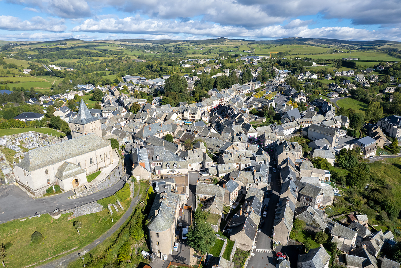
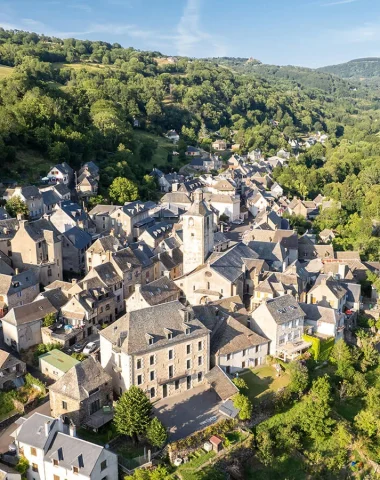
The village of Laguiole, located in the heart of Aubrac Regional Nature Park, is the ideal starting point before climbing onto the plateau. Park on the Place du Foirail in front of the bronze statue of the bull, stroll through the alleys and their houses with slate roofs and walls made of basalt and granite. Don't miss strolling in front of the many shops in the village, visiting the different cutlery and young mountain cheese cooperative to taste the Laguiole PDO. Don't forget to climb to the top of the church at 1 m altitude to observe the 360°C panoramic view.
Step 2: Aubrac, picturesque village
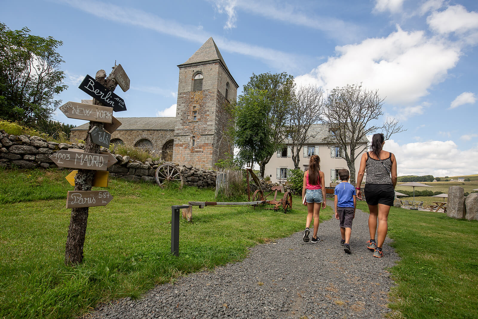
Le village of Aubrac is located at the junction of 3 departments (Aveyron, Cantal, Lozère) and two regions (Occitanie and Auvergne-Rhône-Alpes). It is an essential passage of GR®65 du Way of Saint-Jacques-de-Compostelle. Park in the parking lot in the village. On site, venture to Aubrac Botanical Garden to discover the 650 species of the typical flora of the Aubrac plateau and make a stop at House of Aubrac to learn from our traditions, of our culture and to discover our cultural heritage.. For your lunch break, opt for traditional cuisine in one of the burons near the village. Aligot, an Aveyron specialty, will be served in a preserved, natural and authentic setting.
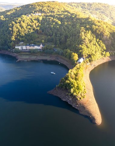
Step 3: The lake of the monks, not to be missed
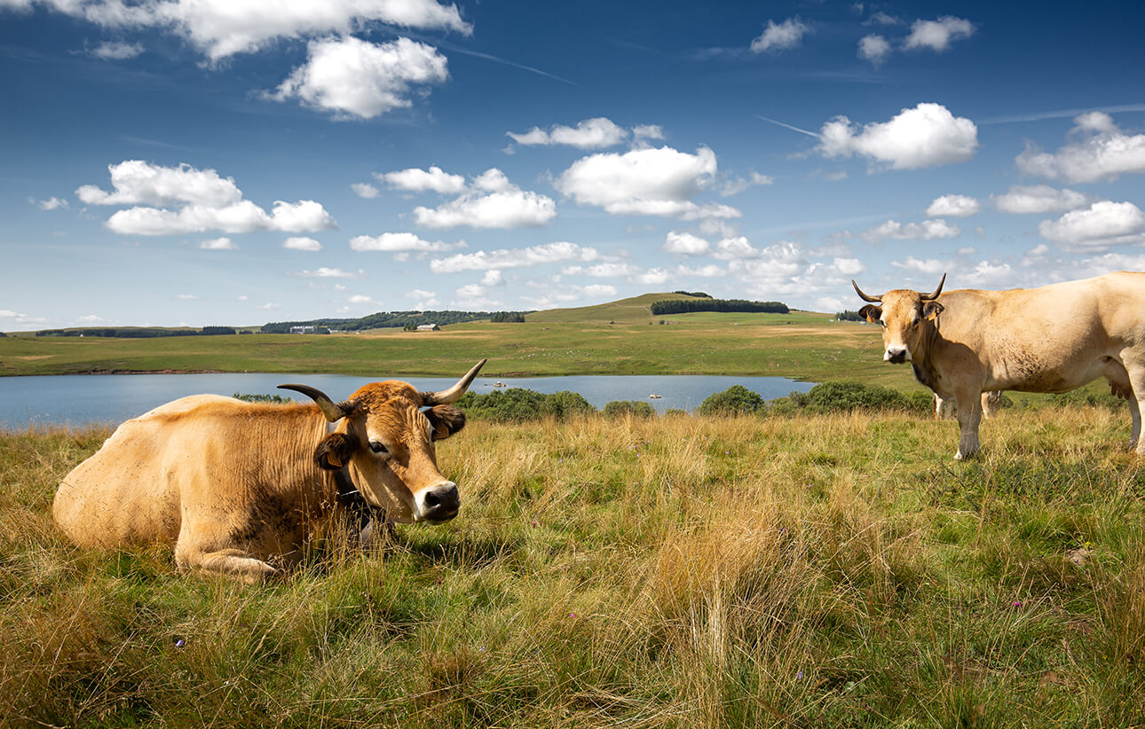
Take a slight detour to monks lake located at 1 meters above sea level. This beautiful artificial lake regulates the flow of the boralde de Saint-Chély-d'Aubrac.
Step 4: Nasbinals, heart of Aubrac
The village of Nasbinals en Lozère is a small town of 509 inhabitants. Park in the village car park where there is a bronze cow baptized “la gaillarde” and contemplate the Romanesque church of Sainte-Marie dating from the fourteenth century. Take the opportunity to stroll through the alleys surrounded by basalt buildings.
Stage 5: The Unforgettable Deroc Waterfall
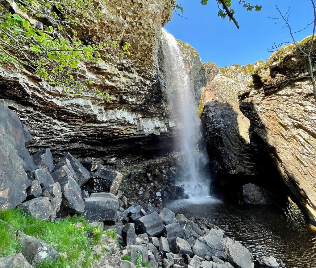
Park in the parking lot of the Deroc Waterfall and opposite, take the footpath. After 5-10 minutes of walking, the path will take you to this cascade atypical 30 meters high. If you go down to the bottom, you can pass under its cave made up ofgiant basalt organs.
Stage 6: The lake route, a corner of paradise
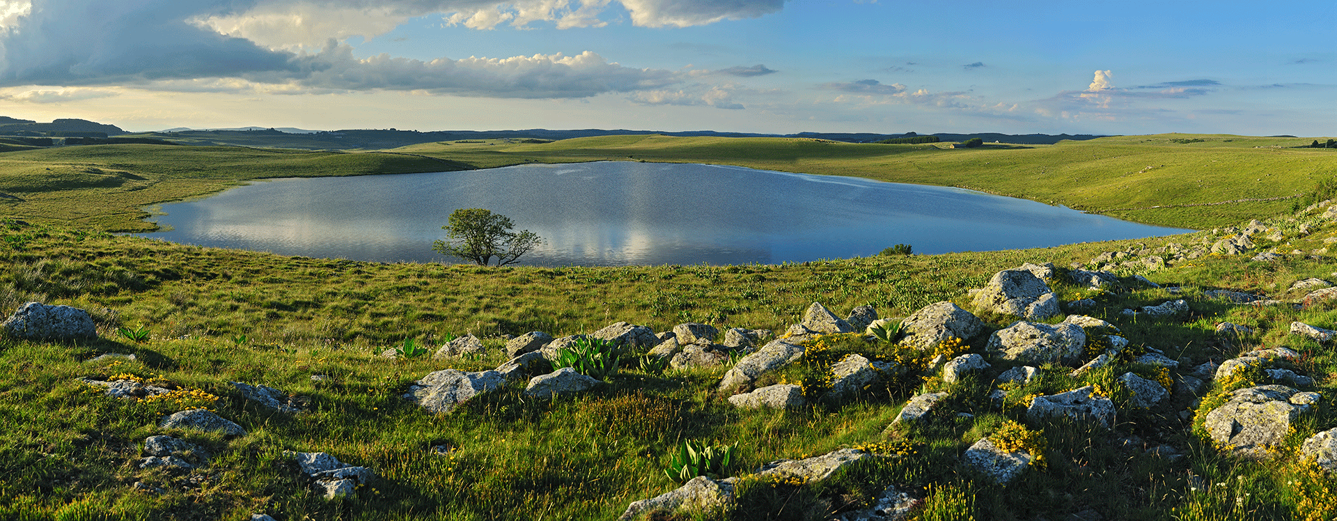
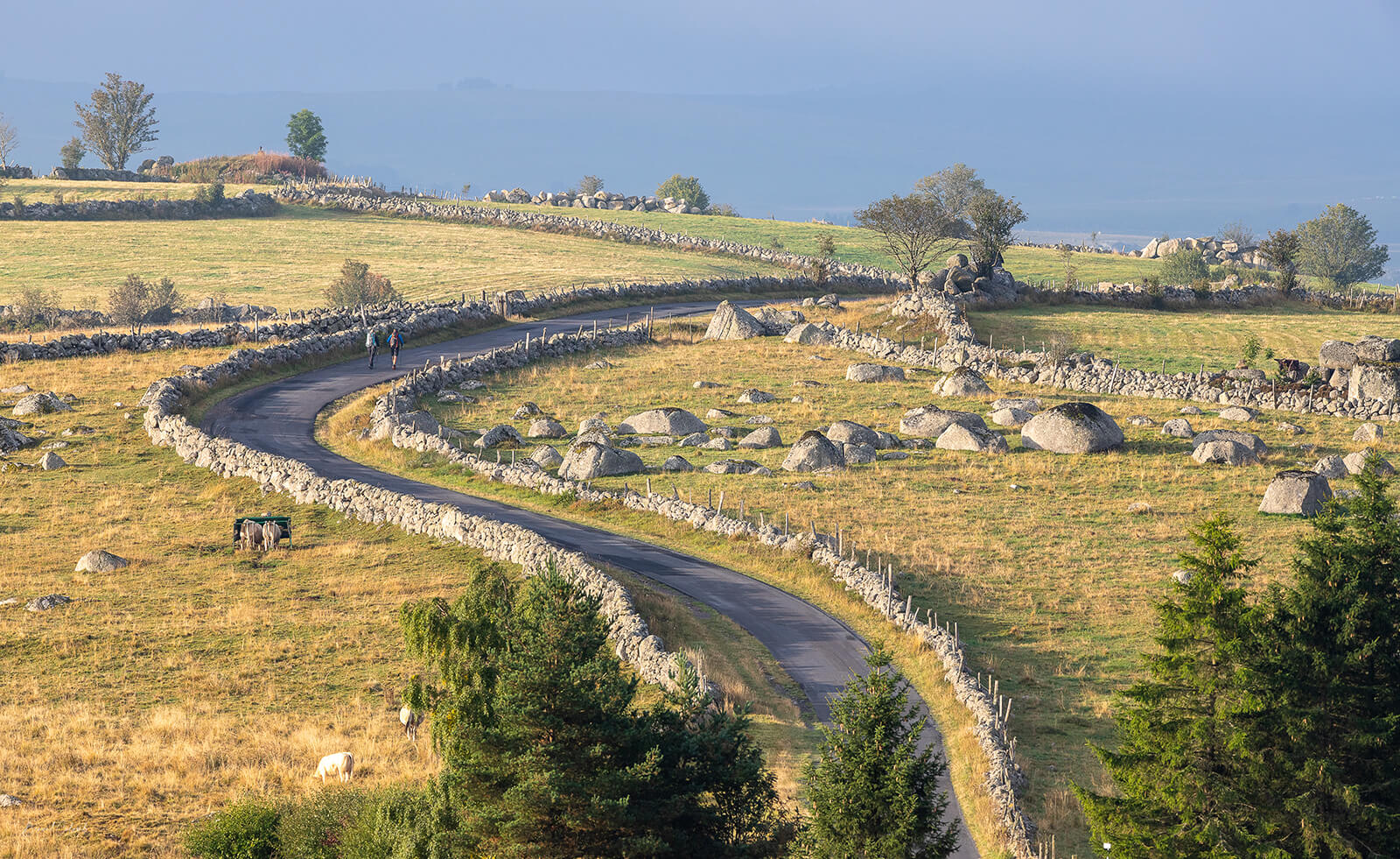
follow her road of the lakes and open your eyes wide to admire the four glacial lakes from the top Aubrac plateau. Salhiens lake, then Souveyrols lake which is visible from the GR® 670 footpath. Further on, pass on the bridge of the Negroes and take the fork on your left which will take you to the superb lake of Saint-Andéol, then to the lake of Born. Be careful, you will have to make a U-turn at the end of this small narrow road which leads to the lake and Buron de Born.
Stage 7: The Col de Bonnecombe, southern slope of the Aubrac mountains
Le Bonnecombe Pass is located at an altitude of 1 meters between the Mailhebiau signal and the mountain of Coumborio. Park in front of the Bonnecombe ski resort and below you will see the small Bonnecombe pond which you can walk around.
Stage 8: The Marchastel bridge, an essential passage of the gr®65
Pass over the Marchastel Bridge ou bukinkan bridge built in the XNUMXth century, then continue on the left fork towards Rieutort d'Aubrac. Observe all along the journey the vast stretches of the Aubrac highlands via Malbouzon and old Brion.
Stage 9: Brion, vast plateau and volcanic land
Stop for a few minutes in the small village of Brion, located northwest of the Lozère, to contemplate the Saint-Hippolyte church and the bread oven communal. Continue on your way and at the intersection, take the direction of Grandvals. Follow the pretty little departmental road along the river “le Bès”.
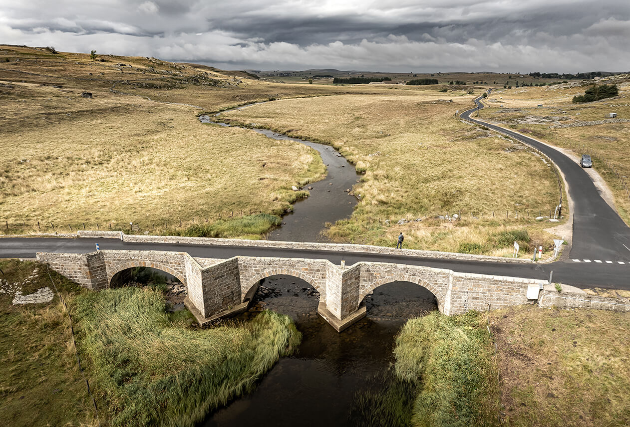
Stage 10: The Pont du Gournier, throne of Bès
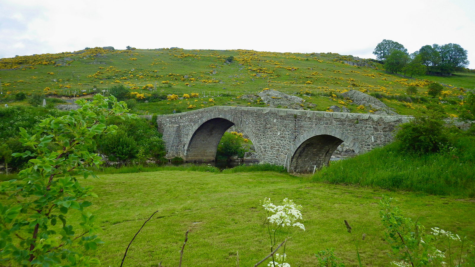
Make a quick stop at Gournier bridge, time for a photo. This beautiful stone bridge, located in the town of Recoules-d'Aubrac, straddles the Bes. Before its construction, a footbridge allowed the passage of the inhabitants towards the other bank to go to the mass of the church of Recoules-d'Aubrac. This footbridge was unfortunately washed away by the floods and gave way to the construction of the Gournier bridge in 1730 (which was reinforced in 1875).
Stage 11: Saint-Urcize, a small town full of character
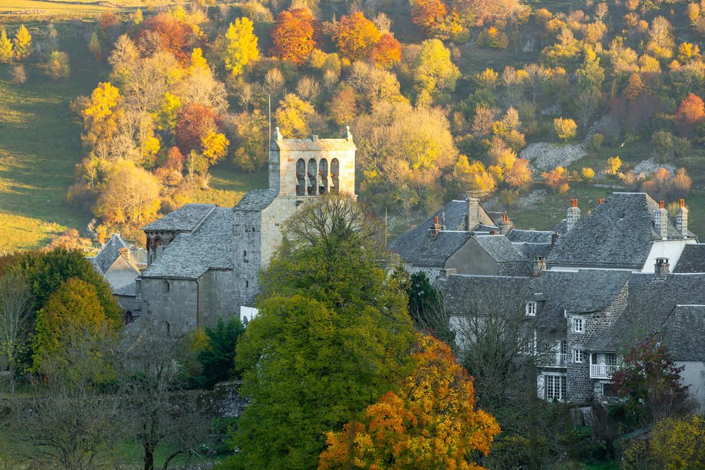
The municipality of Saint Urcize Cantal dominates the Hère and Bès valleys. Take a break in the village car park and visit theRomanesque church of Saint-Pierre and Saint-Michel dating from the XNUMXth and XNUMXth centuries. It is one of the most beautiful churches in Aubrac with its ambulatory choir typical of pilgrimage churches. At the heart of the village, be sure to go up to virgin's rock or a 360 ° view waiting for you. From one of the three orientation tables, you can admire the steeple comb of the church with its four bells, one of which is one of the oldest in France. At the end of this circuit, return to the village of Laguiole passing by the ski resort “La Source”, then passing not far from the famous restaurant of Sebastien Bras “Le Suquet”.
Picnic areas:
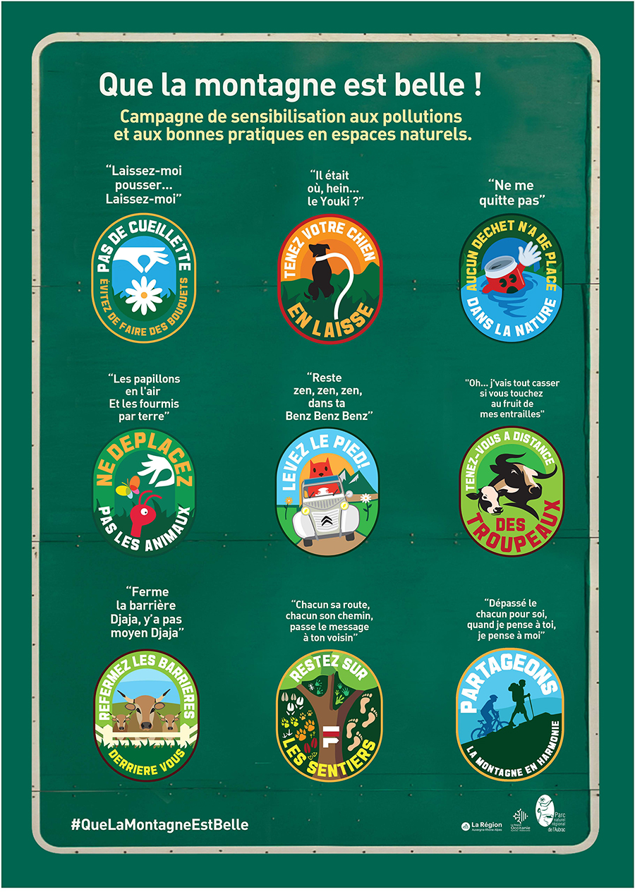
Don't forget to adopt the right behavior!
The high plateau of Aubrac is one of the places still preserved from mass tourism and its sometimes disastrous consequences. Together, let's continue to preserve this natural and authentic environment by adopting the right gestures.