

Cascade Devez, circuit court
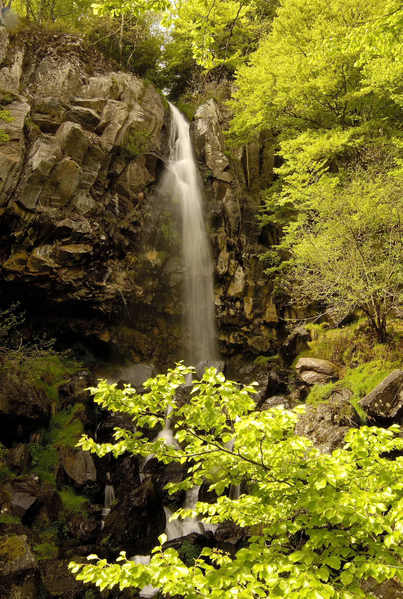
In the heart of the Roquette Bonneval State Forest, a marked and equipped hiking trail to discover one of the most beautiful waterfalls in Aubrac, the 30 m high Devèz waterfall and a wolf pit.
Route details
Description
After the small bridge, a large information panel on the right signals the start (parking). Take the dirt road to the left of this one (heart of the Aubrac State Forest). Go down this path, along the Dourtigouse stream on the right.
At the crossroads, turn right and continue down this wide forest track.
At this crossroads, a sign indicates, on the right, the direction of the “Devèz waterfall” and on the left, the “Fosse à Loup”.
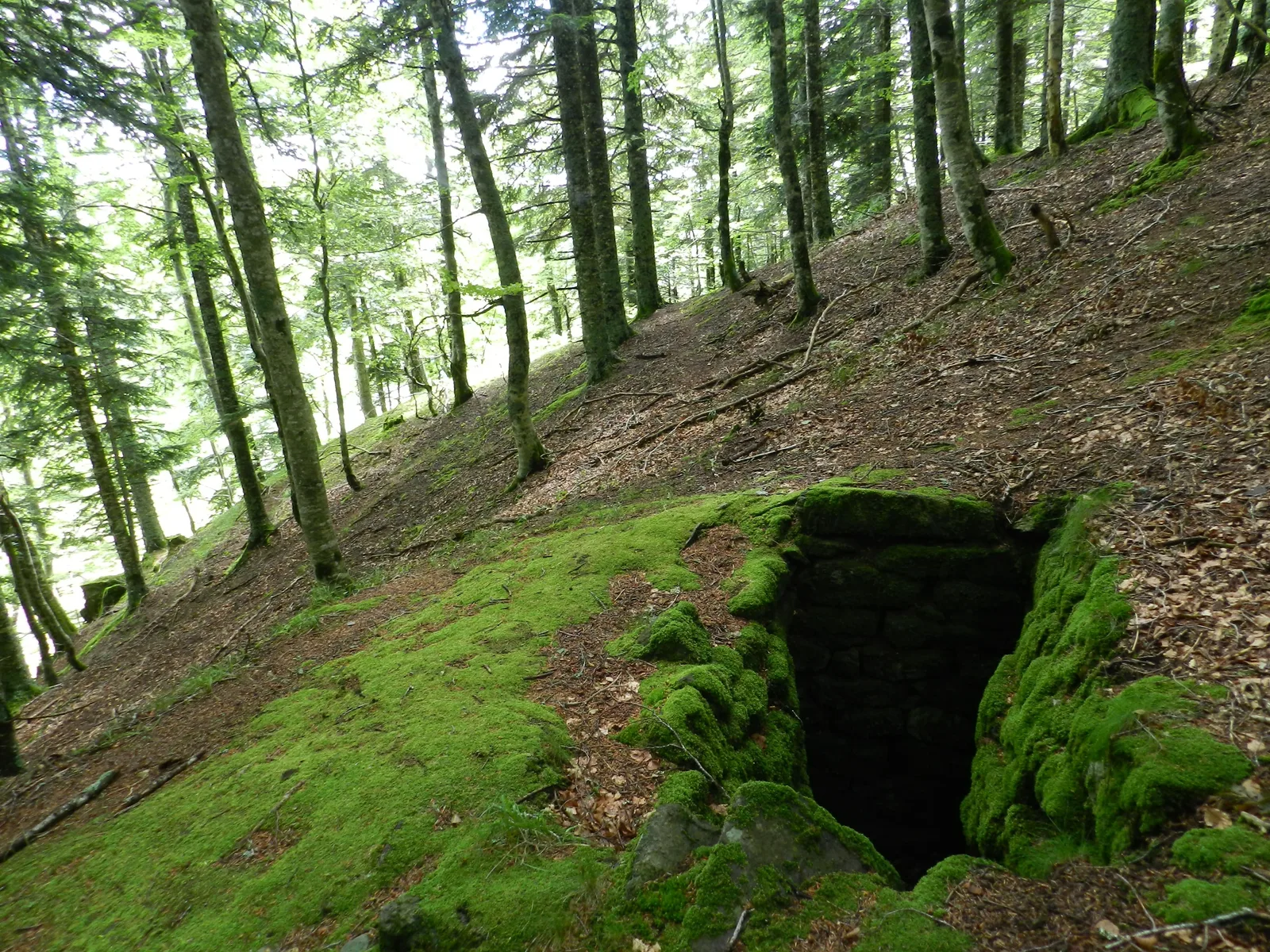
Round trip of 600 m: La Fosse à loup, turn left then right and left again to discover a wolf pit in perfect condition. After discovering the Fosse à Loup, retrace your steps along the small path taken on the outward journey. Note on the left the scree and large blocks of basalt which testify to the ancient volcanic activity and the ice age of the Aubrac plateau. Back at the crossroads, continue left towards the Cascade du Devèz. Continue down the path following the markings (leave the path on your right).
Arrive at a square, at the crossroads of several forest paths. Cross the path, then descend towards the Cascade. Round trip of 400 m: The Cascade du Devèz, a small steep path with steps and ropes, will allow you to reach the waterfall in complete safety. Go up the small path to return to the crossroads on the forest square. Go up the forest track, at the first crossroads turn left then at the second crossroads turn left again. Leave the Fosse à Loup on the left, then the Cascade and continue to climb, staying to the right of the path. At the crossroads on the right, follow the red and yellow markings (GRP Tour des Monts d'Aubrac) and at the intersection of the forest path, turn left. Then arrive at the D 164 road, turn left and follow the road for 300 m, in order to return to the starting point.
At the crossroads, turn right and continue down this wide forest track.
At this crossroads, a sign indicates, on the right, the direction of the “Devèz waterfall” and on the left, the “Fosse à Loup”.
Round trip of 600 m: La Fosse à loup, turn left then right and left again to discover a wolf pit in perfect condition. After discovering the Fosse à Loup, retrace your steps along the small path taken on the outward journey. Note on the left the scree and large blocks of basalt which testify to the ancient volcanic activity and the ice age of the Aubrac plateau. Back at the crossroads, continue left towards the Cascade du Devèz. Continue down the path following the markings (leave the path on your right).
Arrive at a square, at the crossroads of several forest paths. Cross the path, then descend towards the Cascade. Round trip of 400 m: The Cascade du Devèz, a small steep path with steps and ropes, will allow you to reach the waterfall in complete safety. Go up the small path to return to the crossroads on the forest square. Go up the forest track, at the first crossroads turn left then at the second crossroads turn left again. Leave the Fosse à Loup on the left, then the Cascade and continue to climb, staying to the right of the path. At the crossroads on the right, follow the red and yellow markings (GRP Tour des Monts d'Aubrac) and at the intersection of the forest path, turn left. Then arrive at the D 164 road, turn left and follow the road for 300 m, in order to return to the starting point.
