

Sur les hauteurs de Marvejols – VTT n°4
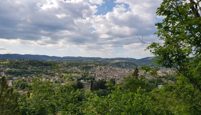
This route reserved for experienced athletes takes up the start of route no. 2 (Tour du Pied d'Escure) and then moves away towards the Boulaine massif which you will follow to the village of Gabrias. A short tour of the emblematic Grèzes trick will then allow you to reach the wide trails dominated by the Midi trick and overlooking the Marvejols valley. FFC Gévaudan MTB site MTB destination – course n°4 black – very difficult level
Route details
Description
Take the footbridge towards the Marvejols esplanade then go up north to the multipurpose room. Take left on Avenue du Cheyla until the roundabout and turn right on Avenue des Martyrs de la Résistance then, at the end of the avenue, left on Avenue de Pineton. Then turn right on avenue du 19 mars 1962 up to the "attic" district, cross a bridge then the hamlet and turn left on the tarmac path which begins to climb.
Continue the ascent on a track which will take you to the Poujoulet plateau. Once on the plateau, at the intersection of several tracks, take the small path on the left to arrive on a small road where you will have to turn left again towards Valadou. Cross the village and continue on the small road towards Molières (nice views of Marvejols). At Molières, the road becomes a path then the path becomes single-track and goes down to the village of St Léger de Peyre, on the banks of the Colagne. Pass under the bridge and turn right towards the houses then left towards a small alley which goes up steeply.
At the top, continue straight on a vehicle track. The presence of large stones will make progress a little complicated but it will then improve. Leave a path on the right and join a wide track. follow it to the left. On the descent, leave a bridge on the left and stay the course. At the road, go up to the right and do the same after 100m. Go up for approximately 1,5km to the D999.
Go left then, 200m later, turn right and follow a road suitable for vehicles. At an intersection of wide tracks, turn left and continue straight. The track descends then narrows and becomes single track. Leave a path that goes to the right, then another that goes to the left and continue straight on. Cross a small bridge and continue the track which goes up through the woods until you cross a road (D999).
Turn left on the road for around 300m then take the first road on the right towards Le Rouve. Leave a first road on the right, then a second, and continue straight on this small road to the village of Servières. Cross the village and take a small path through the houses on the other side of the main square. Take this small path with a descending profile then 500m further on, turn left onto a new path. Continue until you find a road again. 6. Turn right and continue to the village of Espinas. Cross the village and continue on a wide track. Stay on this main track until you reach a new road which will take you to the hamlet Les Coudercs. At the exit of the hamlet, take the small road which goes up to the left and which turns into a path. Once back on the road, turn left and continue straight. Continue on the road and leave a first track which goes to the left, and another which goes to the right
Take the second track which goes to the right and continue it to the village of Gabrias. Pass in front of the cemetery and then take the wide track which goes up towards the D42. Cross the D42 and continue opposite on a small road which crosses the village. Leave a track on the right and continue straight on to a second track. Continue on this track until you reach a crow's foot, turn right and continue until you reach a small road.
Turn right and continue on the road until you reach a junction on the left. The track goes down, at the crossroads continue straight ahead and go up to the village of Grèzes. Cross it, pass in front of the village hall then the cemetery and continue on a new track until you reach a cross, continue straight on until you reach a small road and before arriving on the road, take the path on the left until you reach Chausserans.
Once in the village, take the first left, then, 50m further on, left again on a new track.
1,4 km further on, turn right and take the small path which runs along the meadow then crosses it. Continue on a wide track and take the first chelin on the left to arrive at the village of Les Hermets. Continue on the road, leave the road which goes down to the right and continue straight on to the village of Péjas.
Cross the village and continue on the main track towards the village of Marques. Cross the village and continue on a tarmac road until the first track on the right which goes down to Marvejols.
Follow this track until you find yourself on a small road and continue straight on. The Mascoussel sports complex is in front of you.
