

Les moulins de Beauregard
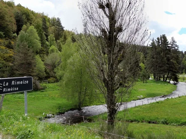
Passing through La Rimeize, discover the mills and some beautiful stone walls that shape the landscape. Discover a wild site in the foothills of Aubrac.
Route details
Description
From the cemetery car park, go down the common path with the GR® de Pays Tour des Monts d’Aubrac trail. Pass in front of a stopover gîte and continue until the iron cross.
Turn left: the path which goes down between two walls crosses the Fau stream, then goes up and joins a road above the hamlet of Vareilles. Go down the road and before the bridge over the Rimeize, take the path on the left which runs along the river. Come out to Chambon. Take the road on the right and cross the bridge over the Rimeize. Continue for approximately 250 m.
Take a path on the left; it goes up into a wood and joins a track. Follow it to the right (let the GR® de Pays trail go on the left). Cut the D 50 (cross), and continue opposite via the road to Monteils (farm). At Monteils, go straight on a dirt road which crosses the plateau. Reach a crossroads (junction with the GR® de Pays Tour des Monts d’Aubrac trail).
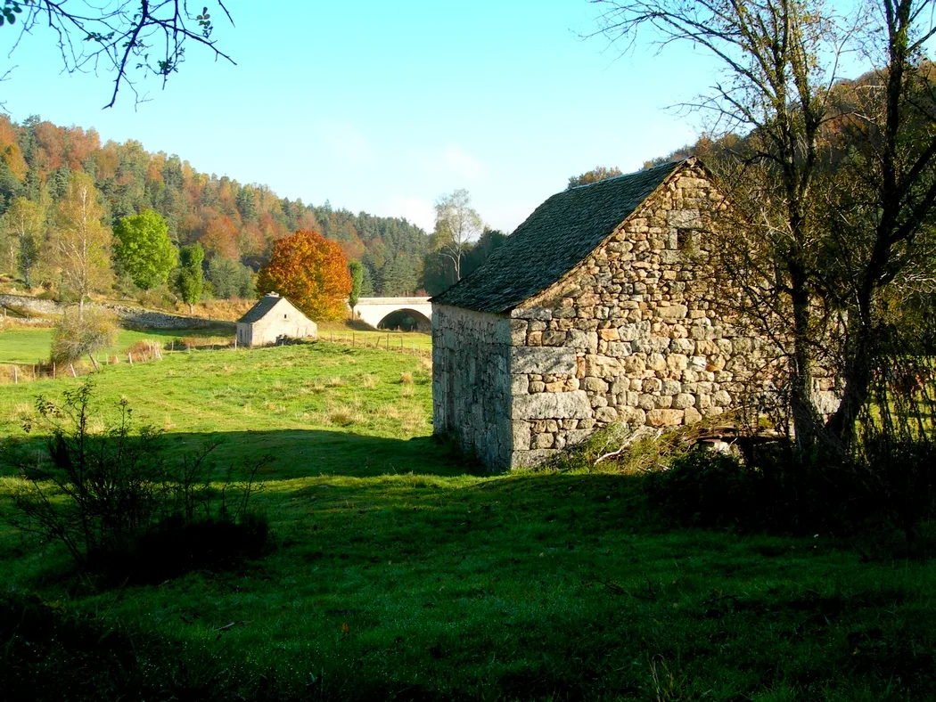
Continue straight ahead until you reach the Bastide cross. Then take the path to the right in the woods (let the GR® de Pays go straight ahead). Further on, it turns right and joins the Rimeize and the Beauregard mills. Take the access road. At the crossroads, turn right onto the municipal road which climbs onto the plateau and winds until you reach a crossroads.
Continue on the municipal road which goes down. Cross the Rimeizenc stream and arrive on the D 50; take it on the right and pass Graniboules. Shortly before the Rimeize (> Moulin de Graniboules), turn left onto the path along the river at the edge of the woods. It goes up between two fences. Opposite, pass in front of the stopover lodge on the way there, then find the starting point on the left.
Turn left: the path which goes down between two walls crosses the Fau stream, then goes up and joins a road above the hamlet of Vareilles. Go down the road and before the bridge over the Rimeize, take the path on the left which runs along the river. Come out to Chambon. Take the road on the right and cross the bridge over the Rimeize. Continue for approximately 250 m.
Take a path on the left; it goes up into a wood and joins a track. Follow it to the right (let the GR® de Pays trail go on the left). Cut the D 50 (cross), and continue opposite via the road to Monteils (farm). At Monteils, go straight on a dirt road which crosses the plateau. Reach a crossroads (junction with the GR® de Pays Tour des Monts d’Aubrac trail).
Continue straight ahead until you reach the Bastide cross. Then take the path to the right in the woods (let the GR® de Pays go straight ahead). Further on, it turns right and joins the Rimeize and the Beauregard mills. Take the access road. At the crossroads, turn right onto the municipal road which climbs onto the plateau and winds until you reach a crossroads.
Continue on the municipal road which goes down. Cross the Rimeizenc stream and arrive on the D 50; take it on the right and pass Graniboules. Shortly before the Rimeize (> Moulin de Graniboules), turn left onto the path along the river at the edge of the woods. It goes up between two fences. Opposite, pass in front of the stopover lodge on the way there, then find the starting point on the left.
