

Le Sentier des Espagnols
This superb circuit starting from the pretty village of Saint-Juéry, will take you, through meadows and small woods, to the remarkable medieval site of Arzenc d'Apcher then to the end of the Grandvals dam reservoir before to follow the Sentier des Espagnols, a balcony path which dominates the Gorges du Bès.
Route details
Description
From the car park, on the right bank, go up to the right, before the bridge over the Bès, an alley which passes under the [> Chapellette]. Follow the road on the left. Go past the sawmill for approximately 350 m.
Turn left, in the middle of the piles of wood and take a path on the right along a fence (junction with the GR® de Pays Tour des Monts d'Aubrac, yellow-red markings). At the next crossroads, continue straight ahead. At Mazel, go down the road on the left. Cross the bridge over the Bédaule and go up [> old mills of Courbepeyre] to the hamlet of Courbepeyre which you cross on the left.
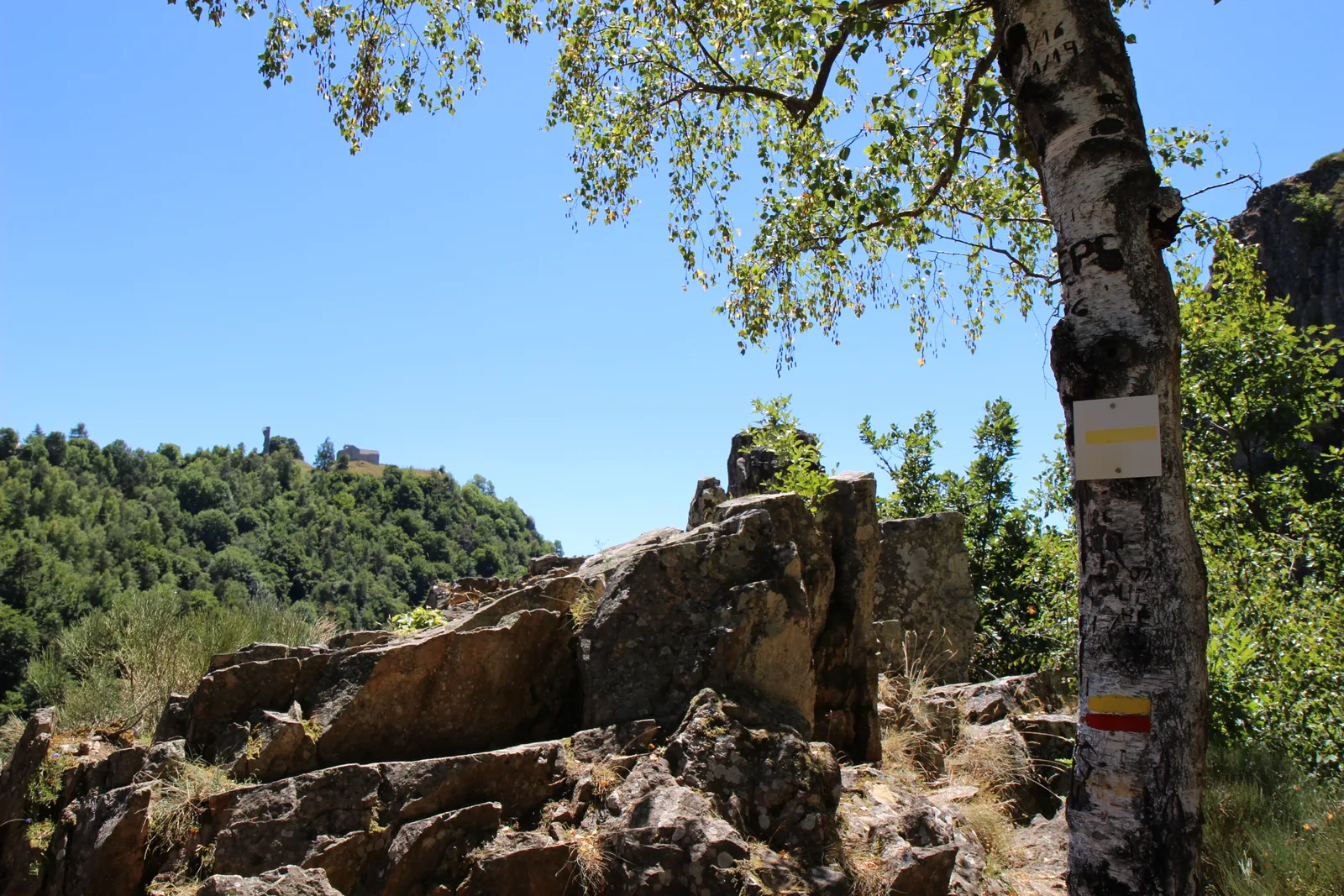
At the next two intersections in Courbepeyre, turn left. The tarmac path turns into a track (junction with the GR® de Pays de Saint-Flour, yellow-red markings). Always continue straight on this track and reach a road. Cross the bridge on the left and go up to Arzenc d'Apcher.> At the cross, about 500 m left, access to the site of Arzenc d'Apcher (common oven, XNUMXth - XNUMXth century church), vestige of tower ( XIV – XNUMXth century.), belvedere over the Bès gorges.
At the cross, take the track on the right [> martagon lilies; views of the Gorges du Bès and the Monts du Cantal] up to Villaret.
At the intersection, take the second junction on the left. At the fork, go down left. At the road, at Les Plagnes (Les Pleignes on the map), immediately take a path on the left that goes down. Reach the D 65 road. Follow it to the left. It winds down to the bridge over the Bès. Continue up the road for approximately 250 m.
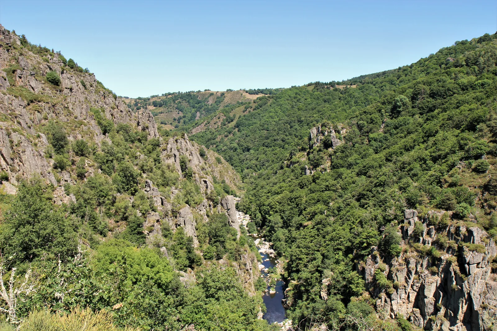
About thirty meters before the bridge which spans the penstocks, go up a path in the undergrowth on the left. It climbs in bends and reaches a crossroads (junction with the GR® of Pays de Saint-Flour, yellow-red markings). Continue opposite, pass a gallery and turn left after the stream. Follow the path called [> Sentier des Espagnes], which remains level and dominates the Bès gorges and provides access to [> climbing routes] [> view of the Bès gorges, Arzenc d'Apcher then the waterfall of Ruisseau d'Arzenc]. Reach a fence at the crossroads.
Cross the chicane and go down the left path. Cross a small stream. Turn right twice, then left twice, always going up and away from the gorges. Reach a T-track junction.
Take the track on the left. Reach a road and follow it to the left. At the cross, at the entrance to Valiette, take the path on the right [> view of Mont Alhérac]. Continue right on the small road and reach a cross and a crossroads. Continue opposite for a few meters.
Take the path on the left, then left along a field. Cross a chicane and head to the right on a more or less marked path. Continue on a path which goes down towards the ruins of the old Combayre mill: it turns right and overlooks [> le Bès]. Gain a road, go down it to the left and reach Bès [> cross richly sculpted on both sides]. Turn left, cross the [> old bridge] to return to the car park.
Turn left, in the middle of the piles of wood and take a path on the right along a fence (junction with the GR® de Pays Tour des Monts d'Aubrac, yellow-red markings). At the next crossroads, continue straight ahead. At Mazel, go down the road on the left. Cross the bridge over the Bédaule and go up [> old mills of Courbepeyre] to the hamlet of Courbepeyre which you cross on the left.
At the next two intersections in Courbepeyre, turn left. The tarmac path turns into a track (junction with the GR® de Pays de Saint-Flour, yellow-red markings). Always continue straight on this track and reach a road. Cross the bridge on the left and go up to Arzenc d'Apcher.> At the cross, about 500 m left, access to the site of Arzenc d'Apcher (common oven, XNUMXth - XNUMXth century church), vestige of tower ( XIV – XNUMXth century.), belvedere over the Bès gorges.
At the cross, take the track on the right [> martagon lilies; views of the Gorges du Bès and the Monts du Cantal] up to Villaret.
At the intersection, take the second junction on the left. At the fork, go down left. At the road, at Les Plagnes (Les Pleignes on the map), immediately take a path on the left that goes down. Reach the D 65 road. Follow it to the left. It winds down to the bridge over the Bès. Continue up the road for approximately 250 m.
About thirty meters before the bridge which spans the penstocks, go up a path in the undergrowth on the left. It climbs in bends and reaches a crossroads (junction with the GR® of Pays de Saint-Flour, yellow-red markings). Continue opposite, pass a gallery and turn left after the stream. Follow the path called [> Sentier des Espagnes], which remains level and dominates the Bès gorges and provides access to [> climbing routes] [> view of the Bès gorges, Arzenc d'Apcher then the waterfall of Ruisseau d'Arzenc]. Reach a fence at the crossroads.
Cross the chicane and go down the left path. Cross a small stream. Turn right twice, then left twice, always going up and away from the gorges. Reach a T-track junction.
Take the track on the left. Reach a road and follow it to the left. At the cross, at the entrance to Valiette, take the path on the right [> view of Mont Alhérac]. Continue right on the small road and reach a cross and a crossroads. Continue opposite for a few meters.
Take the path on the left, then left along a field. Cross a chicane and head to the right on a more or less marked path. Continue on a path which goes down towards the ruins of the old Combayre mill: it turns right and overlooks [> le Bès]. Gain a road, go down it to the left and reach Bès [> cross richly sculpted on both sides]. Turn left, cross the [> old bridge] to return to the car park.
