Le Roc des Pas
This route between plateau and deep gorges provides very beautiful views of the Truyère valley and the Cantal mountains. The "Roc du Pas" will give you the opportunity to let your imagination wander.
Route details
Description
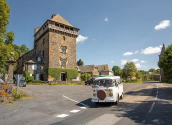
Place in the village of Lieutadès, take the Sauvetat road for 1,5 kilometers to Les Vaissières Hautes.
Cross the village straight on then at the exit take a path on the left between the hedges, follow it for 700 meters and join another path which you take on the right until you reach Sauvetat.
At the crossroads, take the paved road to the left, cross the village and continue to the right along the path that runs alongside the last house. Follow the fence and go down the wide path between two ash hedges.
(Off the circuit: at the intersection, continue straight on until the flat area, follow the fence on the left to the woods, follow the path, cross the fence and continue along the path along the embankment to the Roc des Pas) . At point (4), take the path which goes down to the right to join a path which you take to the right and which leads to Le Poujet.
Cross the D65, take the path to the right of the house and join the D11 which you follow on the right for 500 meters. Branch off onto the path that leads to Estournies. Cross the village and follow the path on the left which joins the D11.
Follow the D11 to the right, cross the bridge and at the next bend, turn right onto the path which goes up into the woods. Pass the fence and follow the path between two hedges to La Borie.
Cross the village and at the exit turn right along a low wall to reach a path between two hedges which leads back to Lieutadès


