

La Chaldette et le rocher du Cheylaret
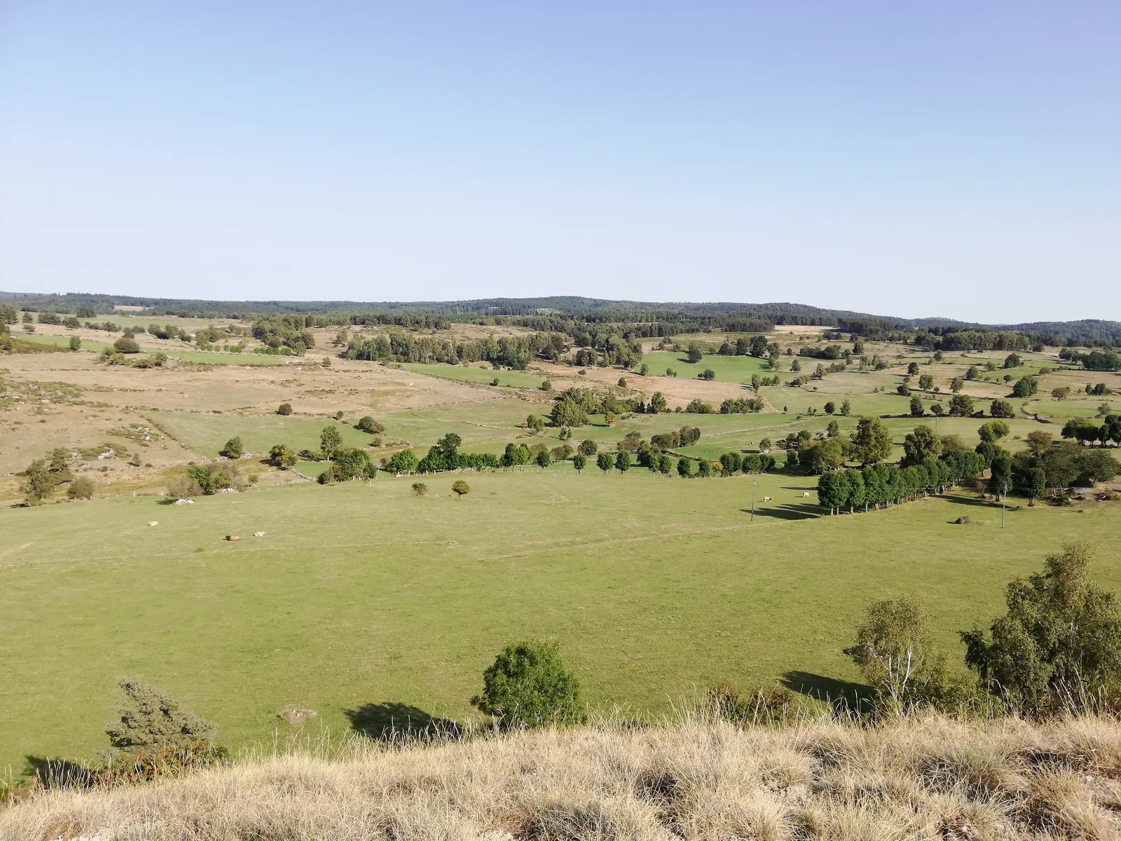
From the banks of the Bès and the thermal establishment of La Chaldette (which offers cures and fitness sessions) this route goes up to Reyrac and passes very close to the Rocher du Cheylaret (1 m), a belvedere which deserves a deviation. Beautiful paths traced in the middle of meadows and pastures will take you through hamlets with a rich vernacular heritage (bread ovens, ox-shoeing looms, watering troughs, etc.)
Route details
Description
From the thermal establishment car park, below the village, go up the D 613. At the intersection with the D 12, go straight ahead then go up to the left behind the accommodation. Pass the [> common oven] and go straight on a path between low walls. Gain a road to Reyrac.
Turn left onto a small road, four banal, continue straight on with a view of the Bès valley. This road goes down and joins the D 12. Take it on the right and pass the Échalouppe junction.
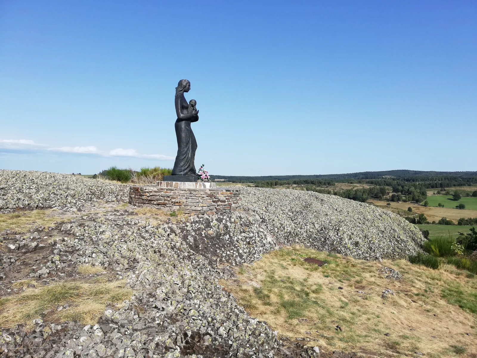
Go up a path on the right. > On the left, access to the Rocher du Cheylaret, (view of the Monts d'Aubrac and the Monts du Cantal, Statue of the Virgin, orientation table). Round trip 15 minutes. Continue to the hamlet of Cheylaret [> bread oven, shoeing loom, cross].
At the crossroads, turn right going down [> trough]. At the bottom of this descent, in a bend, leave the tarmac and take a path on the left between two stone walls, under dense vegetation. Reach a small road, take it on the left and follow it to the hamlet of Fau.
Continue opposite. After about 200 m, go down a small road on the right (pin bend). She goes back up and reaches the Valentine
In the hamlet, just before the [>banal oven], turn right on a path between the houses and pass under a ruin. Continue on the lower path and pass a shoeing loom. Cross the Ruisseau d'Ussels on a [> bridge made of long granite slabs] near the ruins of a mill. About 200 m further on, at the fork, turn left and reach a road.
Take it on the left for a few meters then take the first path on the right. Follow it and reach the D 12. Take it on the right (> caution!) to reach La Chaldette.
Turn left onto a small road, four banal, continue straight on with a view of the Bès valley. This road goes down and joins the D 12. Take it on the right and pass the Échalouppe junction.
Go up a path on the right. > On the left, access to the Rocher du Cheylaret, (view of the Monts d'Aubrac and the Monts du Cantal, Statue of the Virgin, orientation table). Round trip 15 minutes. Continue to the hamlet of Cheylaret [> bread oven, shoeing loom, cross].
At the crossroads, turn right going down [> trough]. At the bottom of this descent, in a bend, leave the tarmac and take a path on the left between two stone walls, under dense vegetation. Reach a small road, take it on the left and follow it to the hamlet of Fau.
Continue opposite. After about 200 m, go down a small road on the right (pin bend). She goes back up and reaches the Valentine
In the hamlet, just before the [>banal oven], turn right on a path between the houses and pass under a ruin. Continue on the lower path and pass a shoeing loom. Cross the Ruisseau d'Ussels on a [> bridge made of long granite slabs] near the ruins of a mill. About 200 m further on, at the fork, turn left and reach a road.
Take it on the left for a few meters then take the first path on the right. Follow it and reach the D 12. Take it on the right (> caution!) to reach La Chaldette.
