

De Termes à Fenestres
This circuit leaves from Termes, whose hill offers a magnificent 360° panorama of the main peaks in the south of the Massif Central and winds its way between meadows and woods. Along the way you will admire an abundant vernacular heritage, ovens, drinking troughs, crosses and cross the hamlet of Fenestres, headquarters of Radio Margeride, a non-commercial associative radio station which broadcasts over almost all of Lozère, half of Cantal and some cantons of Haute-Loire. and Aveyron since 1982.
Route details
Description
In front of the Termes village hall [> shoeing loom], go up towards the village until you reach a first crossroads [> cross]. Continue opposite until the “T” intersection in the village. Turn left, pass the old town hall and the [> honey house].
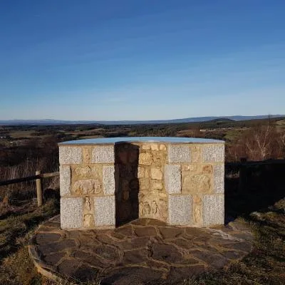
Continue uphill opposite and reach [ > the church] [ > under the cross, at the top of the hill, orientation table: view, from west to east, of Mont Alhérac, the Cantal massif , the Cézallier, the Sancy massif and the Margeride.]
At the end of the car park under the old cemetery, go down to the right and pass between two houses. At the crossroads, turn left and continue on the path. NB: We can also retrace our steps.
If you have chosen to retrace your steps, turn left between the houses and continue on a path. Reach a T-junction, turn left, then left again onto a small road. At the cross, turn right, then approximately 150 m further down, in front of an agricultural building, take the path on the right. Reach a road in a bend, follow the path to the right until you reach a crossroads.
At the intersection, turn left. Once on the road, follow it for a few meters then take the path opposite. Reach a crossroads.
Take the path on the right to the hamlet of Vassals.
In this hamlet, at the cross, take the path on the left, climb into a pine wood, ignoring the path departures on the left or right. Gain a road. Follow it to the right [> view of the Margeride and the Truc de Fortunio (1 m) and the wind turbines of the Col du Can de la Roche]. Take the first path on the right. At the fork, go down left, cross Fenestres [> Radio-Margeride premises, fountain, wash house].
At the crossroads, go down opposite. At the fork, continue left downhill to the Vigours stream.
At the crossroads, turn right and continue straight on to Clavières. Cross the road and continue opposite. Take the road opposite for about a hundred meters until you reach a crossroads [> cross dated 1826].
Take the path on the right [> view of Termes and Mont Alhérac]. At the crow's feet, turn left on the path followed on the way out. Turn left three times then right once to go back to the village of Termes and return to a tarmac path lined with houses. At the crossroads, go down left then right and reach the starting point.
