

Du Déroc à la Peyrade
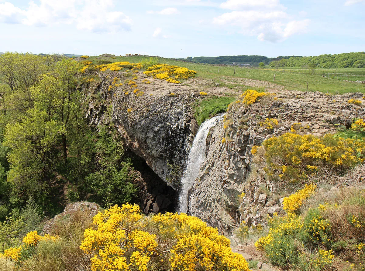
Departing from Nasbinals, in the heart of the Aubrac plateau, this circuit will take you near the Lac des Salhiens, which fills a basin of glacial overdeepening. Then you will pass over the Déroc waterfall, the outlet of the Salhiens lake which drops 32 m from the top of a cliff of basaltic "organs". Finally, you will walk at the foot of La Peyrade, a rocky summit which dominates the summer pastures.
Route details
Description
From Nasbinals town hall, go down the road, going around the apse of the church [> church (XNUMXth-XNUMXth century)]. Leave the main road and go down left.
Cross the D 987 (> be careful!) and follow the D 900 (direction Marvejols) for approximately 250 m.
After the cemetery, take the road on the right for 300 m (junction with the GR 670 Chemin Urbain v, white-red markings) and continue along the stony path for 800 m. At the crossroads, at a barn, take the path between two low walls which goes around this barn to the right, then take the path on the right. Ignore the discovery trail by continuing straight ahead. The path passes to the north of Lac des Salhiens, 500 m away [> interpretation panels; view of the Cap Combatut mountain, the Rabios woods opposite, the Alte-Teste puech, the Mailhebiau signal, on the right] and leads to a parking lot. Cross the D 52 (> be careful!).
Continue opposite to the [ > Déroc waterfall ](café in summer). At the end of the well-marked path, which passes above the waterfall, continue opposite, passing to the right of a farm building; 250 m further, turn right and join a mining road. (The foot of the waterfall is accessible by a path (5 minutes). There are also basalt blocks of varying sizes resulting from the retreat of the cliff through erosion.)
Take this wide track on the left and reach Montgrousset. Take the D 900 on the left for a few meters.
Cross the D 900 (> be careful!) and turn right into the village. Follow this small road until Montgros.
At the crossroads, turn left then immediately right. The path heads due north [> view of the Monts du Cantal to the NNW and the Monts Dore to the NNE] and goes around the rocky summit of La Peyrade (1 m) to the left. Reach the hamlet of Cher. Follow the local path which passes next to the Buron du Ché (restaurant) and reach the D 223.
Take the D 987 on the left for around 300 m (> be careful!). Shortly before a cross, take the left-hand farm path. Ignore the start of a gravel track on the left. At the next crossroads, go up left and continue straight due south, ignoring all the trailheads on either side. Reach the GR 65 (Chemin de Saint-Jacque-de-Compostelle, white-red markings).
Follow it on the left towards Nasbinals. Take the D 900 and follow it to the right until the cemetery (>be careful!). Return to point 3 then 2.
