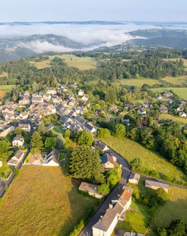
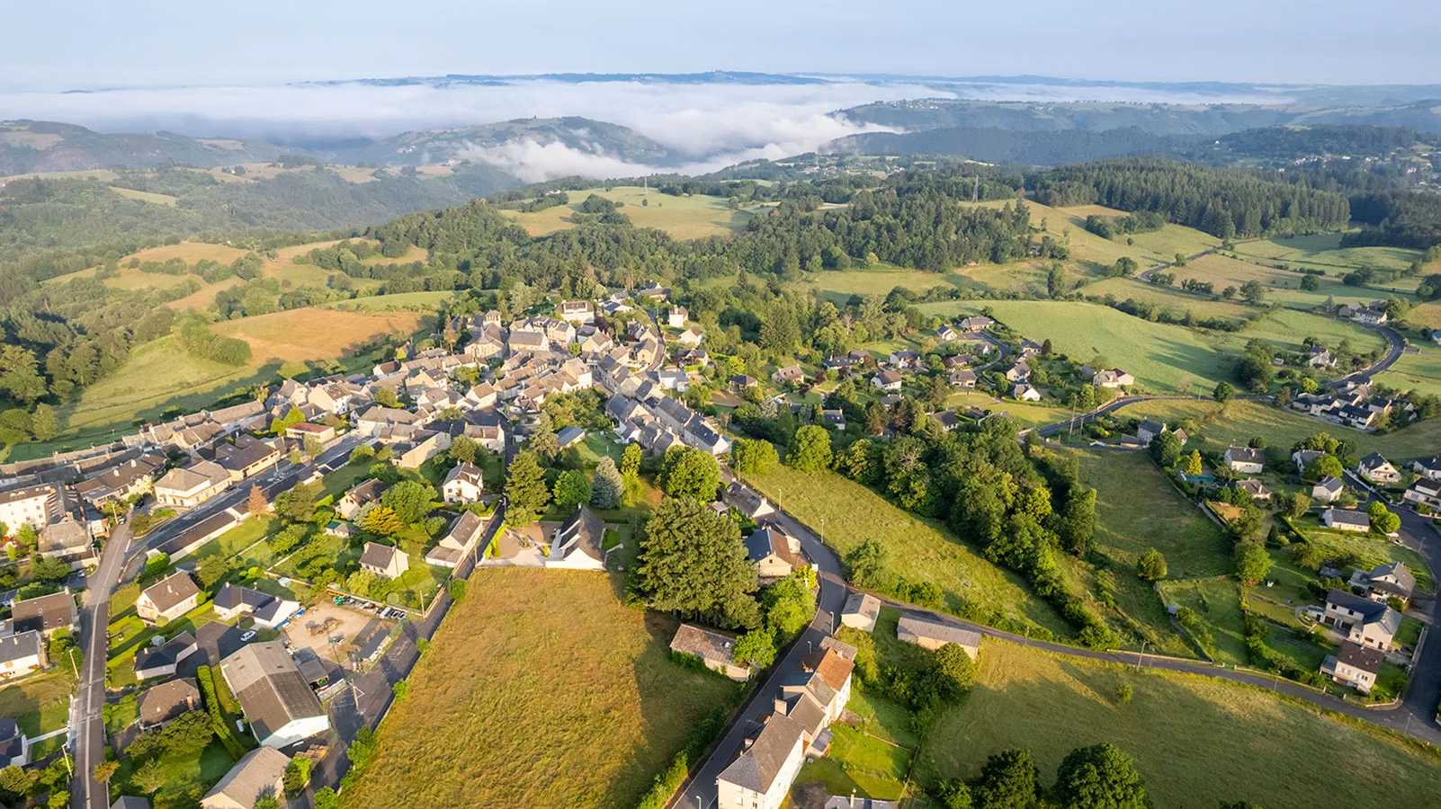
La Viadène is located on the western foothills of Aubrac, between the Lot Valley and the Gorges de la Truyère. The landscapes are varied and contrasting. On one side, you can admire the Viadène plateau which culminates between 700 and 900 meters and offers vast pasturess where cattle farming predominates. On the other side the landscape changes in a few kilometers to give an overview more and more picturesque; the altitude rapidly increasing from 600 to 200 meters.
The origin
The origin of the word Viadène remains today mysterious. Many theories have been advanced to try to explain it but none of them could be clearly approved.
Some claim that it was the Romans who used this name first. According to them "via" would mean way and "dena" would be used to say that it is the tenth way. This assumption is called into question because the Romans gave names to their routes instead of numbering them.
It is also said that Viadène derives its origin from two Latin words "via asini" which means "way of beasts of burden". Indeed, many donkeys and mules used to carry trade goods in narrow and steep paths.
A third explanation would be a contraction of "via del nalt" which means way from above. This is explained by the fact that previously there was no path linking Estaing to Entraygues-sur-Truyère. The travelers then had two possibilities either to follow the path from below which ran along the Lot or the path on the plateau : “lou comin del nalt” (the high path) called also the “via del nalt"which gives by contraction"Via de na".
We can see that the common point between all these hypotheses is that the origin of this word would be the way. Viadène has always been a place of passage and exchanges, this region was and remains the link which unites the Lot valley to the Aubrac plateau.
Location
La Viadène mainly comprises six municipalities: Campouriez, Florentin-La-Capelle, Huparlac, Montézic, Saint-Amans-des-Côts and Saint-Symphorien de Thénières, as well as many sites for visits and varied activities.
The main sites to see
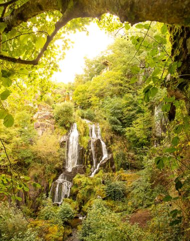
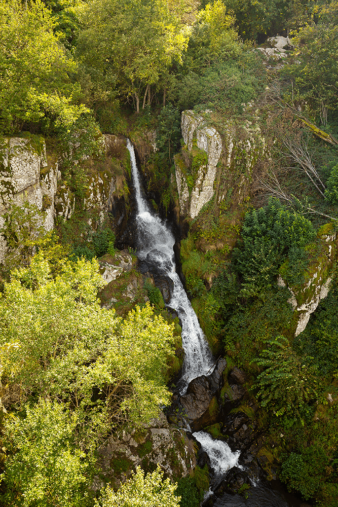
The dog jump
The Saut du Chien site is a succession of waterfalls in a granitic chaos where the small stream of La Plane flows. Besides the various legends, the name of this privileged place is due to this large rock that can be seen at the foot of a cascade surmounted by a stone dog head shape.
Two platforms have been built overhanging, which allows walkers to discover this picturesque setting a little better, to see below the Couesque reservoir on the Truyère and also on a peak, on the other side, the village of Valon with its castle dating from the XNUMXth century.
To get there :
- Hike (2-hour loop), yellow markings, departing from the Bijoux Lyseth Création workshop in Monnès.
- Botanical trail from Le Laux (45 min loop).
- Walk (20 min round trip), from “Le Laux”.
Find hiking sheets of these routes in our tourist information offices.
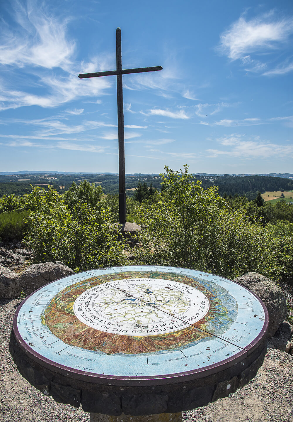
The Pic du Castel
Place where there was a castle, property and summer residence of the Counts of Rodez.
Located at an altitude of 755 meters, the Pic du Castel offers a wide panorama of the Gorges of La Truyere, On the Aubrac plateau and on Cantal mountains. From its summit it is easy to find your way around thanks to the orientation table.
You can reach it on foot via the hiking trail, or by car to the nearby car park.
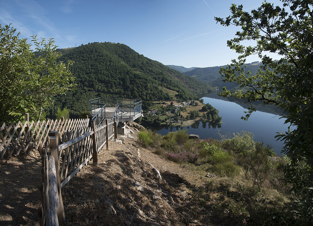
The Fajol promontory
On the path of Fajol hike (Campouriez), a promontory has been built. In a natural setting, the view is magnificent, overlooking the Truyère, the hamlets of Izagues and Izaguette. To get there you have to walk a bit. From the village of Campouriez, allow about thirty minutes to get there.
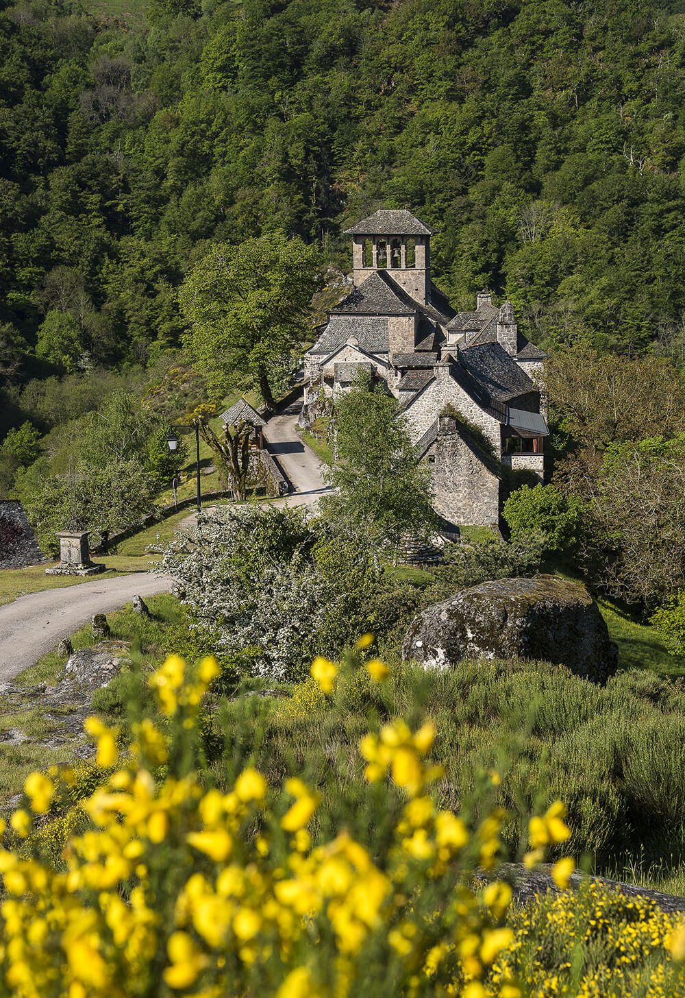
Bes-Bedene
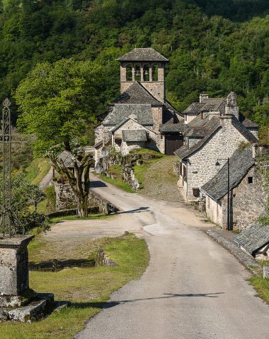
Picturesque site, Bes-Bedene is on a granite rock outcrop embedded in a remarkable circus shaped over the centuries by the river Selves and majestically dominated by the Puy de Montabès.
Rich in history since the founding of the parish in the 11th century, Bes-Bédène is worth a visit. After the church (with its Altarpiece dating from the 18th century depicting the mysteries of the Rosary), the exhibition rooms (reconstruction of a classroom from the middle of the last century and Espace Charles De Louvrie, French engineer author of the first patent describing a jet propulsion system), the visit can continue with a very pleasant walk to the pont. The latter, built in granite, was built before 1292 and repaired in 1410. 13,50 meters high, 39,90 meters long, it has a single arch, semi-circular.
For exploration enthusiasts, take the path at the end of the rocks, it will take you to the loose stone.
The Puy de Montabès
The Puy de Montabès or Puech de Montabès, located in the town of Florentin-La-Capelle, peaks at 774 meters. This ancient oppidum would have served as a relay for Roman penetration, as the historical traces found on the site suggest.
From its summit you will discover an extensive view over the entire region with its typical villages, its landscape with many valleys as well as the rocky spur of Bes-Bédène. The orientation table will help you locate them.
The altarpiece of the church in Saint-Amans-des-Cots
It was painted by Ludovicus Gomez and dates from 1626. It depicts the Rosary surrounded by mysteries. It is an oil painting on wood which measures approximately 2m80 x 3m50. Its particularity is its large dimension uncommon for an oil painting on wood.
- On the left, the 5 joyful mysteries : the Annunciation, the Visitation, the Adoration of the shepherds, the Presentation in the temple, Jesus among the doctors.
- At the bottom, the 5 painful mysteries : Christ on the Mount of Olives, the Flagellation, the Crowning with thorns, the Carrying of the Cross, the Crucifixion.
- On the right, the 5 glorious mysteries : the Resurrection, the Ascension, Pentecost, the Assumption, the Coronation of the Virgin.

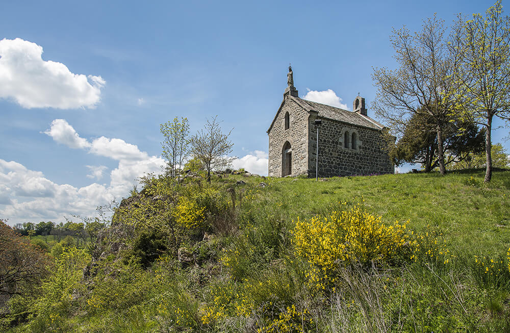
The Chapel of the Rock
Chapel overlooking the village of Huparlac, it rests on magnificent basalt organs. It was completed in 1868 and is dedicated to the Blessed Virgin. Note a particularity concerning the framework: it is supported by two agglomerated and arched trusses, a system not very common in our region and which we owe to a French architect: Philibert Delorme born in Lyon around 1510 – 1515.
Magnificent view of the village and the Aubrac mountains.
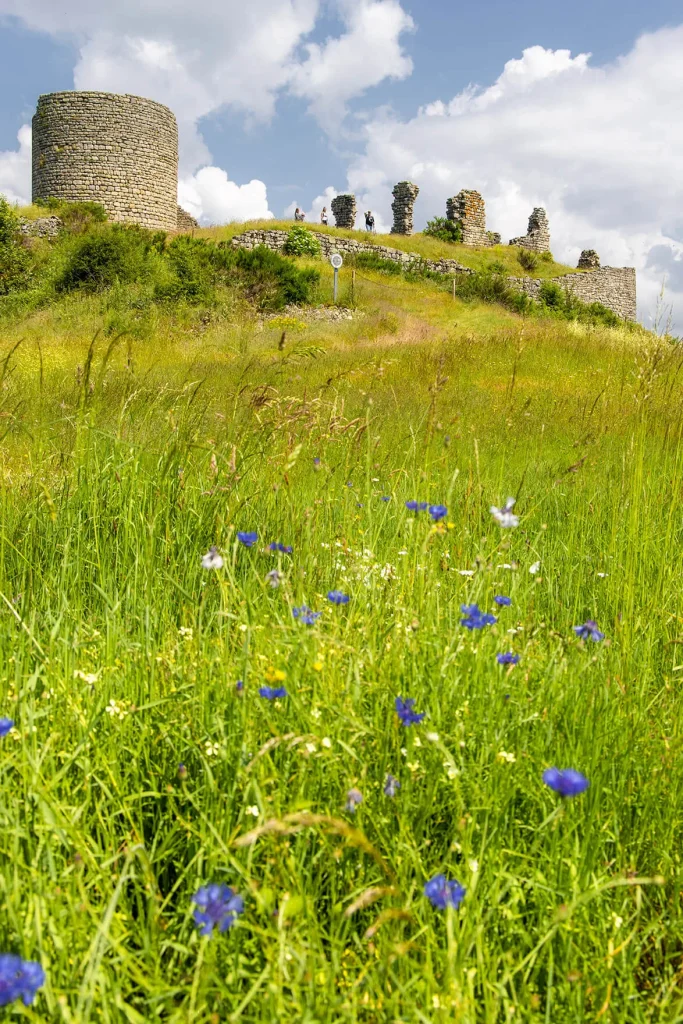
The Château de Thénières
Located on the highest point of the region, this fortified castle was an ideal site for monitoring the surrounding area. The barony of Thénières was one of the most important in the region for several centuries. In 1210 Jean de Beaumont, lord of Thénières, would have succeeded in mobilizing the surrounding inhabitants and, with the help of the Count of Montfort, would have successively freed Rodez, Laguiole, Mur-de-Barrez and many other places from the Albigensians. and Bulgarians who invaded this country. Today two orientation tables allow you to identify the places in this vast panorama:
- Possible two-hour hike, yellow markings, leaving from the village of Saint Symphorien de Thénières.
- 30-minute walk (round trip) on foot, from the hamlet of “Saintignac”.
The villages
Saint-Amans-des-Cots
The village is built on the plateau of Viadène, on the foothills of Aubrac, between the Lot Valley and the Gorges de la Truyère. Culminating at 730 meters, the town developed around the old village built near the current church. Hydroelectric production has changed the economic climate by creating important bodies of water, thus promoting the development of tourism (establishment of campsites, practice of water sports, fishing, etc.).
Campoured
Campourize is a valley country. The Campouriez name is closely associated with the vine cultivation, which already highlights its uniqueness within the canton of Saint-Amans-des-Côts.
This land of vineyards, with its hilly terrain and wooded slopes, is an undeniable tourist attraction, and the village itself is nestled in the center of a triangle formed by the Selves, Gouzou and Truyère gorges.
Florentine La Capelle
Commune having its lowest point at Leth (240m) and its highest point at Puech de Montabès (774m), former oppidum offering a magnificent panorama, with its orientation table and its group of trees visible from afar. The village is located on the hillside neighborhoods, are the castle recounted in numerous documents, in ruins at the end of the XNUMXth century, has now disappeared. Its Saint-Laurent church, dating from the end of the XNUMXth century, with which the castle communicated by an underground passage serving as a refuge for the inhabitants during the looting carried out by the Great Companies which terrorized the region in the Middle Ages.
Huparlac
Huparlac is located at Viadène center, a crossroads that unites the cantons of Saint-Amans-des-Côts, Sainte-Geneviève-sur-Argence and Laguiole. Homeland of the poet Fromen, the village only knew its importance at the end of the XNUMXth century and especially in the second half of the XNUMXth century, with the creation of important roads. From these periods date beautiful residences, in particular the Christmas House, type Louis XV of which a part is used today as town hall. You can see a beautiful staircase with baluster and oak rubble.
Montezic
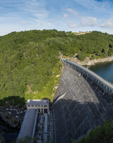
Here we find the locality of the canton with the most letters of nobility. In the Middle Ages, at the foot of its fortified castle (now destroyed), property and summer residence of the Counts of Rodez, lived a large population benefiting from large exemptions and which included in particular a military garrison, several consuls "Having the right to porter chaperon", notaries, craftsmen and merchants, reinforced by the importance of a recognized weekly market of regional character. For a long time with an essentially agricultural vocation, the municipality of Montézic has managed to maintain its local crafts and to diversify, in particular by setting up a knife making de Laguiole and thanks to the jobs created by the EDF power plant, hydraulic central of the most powerful at the national level.
Saint-Symphorien-de-Thenieres
The town is essentially agricultural vocation with a tourist activity quite important on Saint-Gervais, thanks to the 3-star campsite and the 16-hectare lake, where you can indulge in nautical activities. Among the monuments to visit, we can mention the church of Saint-Symphorien-de-Thénières from the XNUMXth century, as well as that of Saint-Gervais from the XNUMXth century. To enjoy a marvelous panorama over the Monts du Cantal and Aubrac, you have to go to the highest point of the canton which is the Thénières site, 943 meters above sea level, where the remains of the old castle of the twelfth century.